Monday, July 25, 2016

Bugaboos Part I

They say a picture is worth a thousand words.  But what about a thousand pictures?  Well not even that can do justice to the beauty of the Bugaboo Provincial Park.  Wildly aesthetic granite spires, adorned with splitter crack systems, rise up from the glaciated terrain in a way that captures the hearts and dreams of all climbers that gaze upon them.
snowpatch spire from the top of bugaboo spire
After my bugaboo plans last august fell through, I was super excited to visit this summer.  The morning after my summer internship ended, Chad and I hit the road, knocking out the 10 hour drive and 2 hour hike-in to camp at Applebee.
classic TH picture of chicken wire to protect against rubber eating porcupines
With rain in the forecast for the next day, we opted for a short route close to camp – Ears Between (II 5.7 6p) on Crescent Tower.  By simuling the first 3 pitches followed by 2 pitches of 5.7, we made good time and were back in camp before noon.  With the weather still looking good, we grabbed a snack and a larger rack before heading up to the classic McTech Arete (II 5.10- 6p).  The climbing was spectacular and we topped out minutes before the rain arrived, which came and went as we rappelled down.
looking down towards camp from the base of Ears Between
Chad on McTech pitch 4
splitter 
With better weather forecasted for the following day, we were up early and headed for the ultra classic NE ridge of bugaboo spire (IV 5.7 10p).  We passed 3 parties on the approach and luckily were the first party on-route.  By the time we were climbing pitch 2, there was a party on pitch 1 and 5 additional parties cueing up at the base!  We led in blocks, with Chad taking the first 3 pitches to gain the ridge proper before I took the sharp end, leading the pitch 4 corner and an excellent hand crack variation on pitch 5 before we entered the prominent chimney and simuled the remaining 5 pitches to the top in 2 large blocks.  
approaching the NE ridge
crowds at the base, luckily we got up early and hiked fast
all smiles atop pitch 4 (photo: chad hiatt)
pitch 5 handcrack variation
nate and kevin on the traverse

me atop the N summit of bugaboo spire (photo: nate duray)
view of the howsers and upper vowell glacier
The traverse of the multi-tiered summit made for exposed but easy simuling before making the long, slow descent down the kain route (we did 4 rappels and downclimbed raps 5 and 6).  Once at the BS col, we shared ropes with another party to make 2 60m raps since we had opted not to carry axes on route.  We were back in camp slightly over 11 hours since departing, stoked on a great day on such an incredible route.
descending the kain route
climbing the BS col (fortunately there was enough snow so it was in great shape for the duration of our trip)

the nasty W side of the pigeon-howser col

pigeon feathers from east creek
We awoke to rain on day 3 and spent a few rainy hours sleeping/reading in our tents before the weather cleared.  We then packed up for a hike over to the east creek bivy sites, to put us in position to attempt the world famous beckey chouinard route (V 5.10 15p) during the upcoming weather window and to get away from the noise and crowds of the packed Applebee campground.  Climbing the BS col with heavy packs was a bit rough but we topped out about an hour after leaving camp and departed across the vowell glacier.  Descending the pigeon-howser col was straightforward and we were pleasantly surprised to find we had the gorgeous east creek bivy area all to ourselves for a few hours before 2 other parties arrived that evening. 
S howser tower and the minaret as seen from our east creek bivy

Stay tuned for part II for our adventure on the beckey chouinard route as well as pigeon spire on the return to Applebee.

Sunday, July 10, 2016

Hyalite Peak to Mt Blackmore Traverse

After spending the past 2 weekends climbing in loose preparation for an upcoming trip to the bugaboos, I was extra excited to get out for a long run/scramble in the mountains. 
looking S at the bulk of the route with hyalite peak in the distance, L of center
My route of choice was the somewhat classic hyalite peak to mt blackmore traverse.  I elected to go in a S to N direction to take advantage of the easy runnable grade of the hyalite peak trail but there are certainly other advantages to doing it in reverse (deal with the rough, slow terrain earlier in the day, easy to bail down the trail into the shower creek basin if needed and be able to swim in hyalite lake prior to running the trail down at the end of the day).
one of many beautiful sections of hyalite creek
closing in on hyalite peak 
looking down canyon from atop hyalite peak
I parked at the blackmore TH and ran an easy warmup 4 miles to the hyalite TH.  Another 6 miles of great running put me in the basin below hyalite peak where I filled water and hiked to the top (one snow-covered switchback but easily avoided).  I ate and left a quick note in the summit log while soaking in the incredible view of mountains in nearly every direction.  I then headed N along the ridgeline on some fast, easy terrain over a series of unnamed highpoints.  I was a little surprised to cross paths with another runner shortly before divide peak who was in the midst of the same traverse in the opposite direction. 
scenic shower creek basin, hyalite peak in distant center
shelter for those benighted on route? 
rougher than it looks section from mt bole to elephant mt

optional but fun class 4 section on really unique rock

always cool to cross paths with mt goats in the mountains
From divide peak the pace slowed a bit as the terrain grew rougher but it was still easy going to mt bole.  Unfortunately storm clouds were building overhead put I pressed onwards towards elephant mt on the slowest and roughest terrain of the route.  It was cool to see a large group of 15+ mountain goats through here.  Once down from elephant and on the blackmore trail, I was pleased the legs still had enough pep to comfortably run to the top.  With storms clouds still threatening, I quickly finished my food and water before bombing down the approx. 6mi trail to the truck.  A quick swim in the reservoir rounded out the day.

Stats: about 24mi/7k vert in just over 8 hrs (4mi/40min of that was road between the two trailheads)

Rose: just a great day out in the hills exploring some new country
Thorn: stressing over storm clouds for multiple hours (but fortunately nothing materialized til back in town running errands)
Bud: returning for a similar traverse on skis, including a descent of this beauty
pinner couloir?

Sunday, June 26, 2016

Old Gabe 50k race

With an 8 week internship in Bozeman for the summer, I knew I’d be running on the trails in the bridger range outside of town quite a bit.  Therefore it was kind of a no-brainer to sign up for old gabe.  Plus, it encompasses most of the things I love about running – steep (11,000 vertical), exclusively singletrack, and through beautiful terrain.  On top of all that, it’s a refreshingly low key race environment and one of the most affordable races around ($50 for 50k).  All in all, highly recommended.

After a quick check-in and warmup, we were off, a combined group of nearly 100 runners for both the 25k and 50k.  It was a little strange in the initial mix-up for the few minutes of passing and getting passed, not knowing whether your fellow runners were in it for the long haul (50k) or doing the 25.  I tried to ignore it and just stick to a fairly easy pace for the initial 4mile climb.  I topped out feeling great and dropped into the snow and mud of the N facing terrain of the bostwicks.  Two muddy descents and 2 short climbs put me atop truman gulch where a newly re-routed trail apparently added a half-mile to the course (each way) which I cruised down to the truman aid station (9mi).
looking N at the course across the bostwicks a week before the race on an excellent saddle
peak to baldy mountain loop from middle cottonwood
A few minutes shy of 2 hours, I was right where I wanted to be and scarfed down some food and refilled water before starting the long climb back up Truman.  It was fun to see and cheer on fellow runners on the out-and-back format.  I set a goal of passing 5 people on this 5mile climb and succeeded, passing my 6th on the snow just before the top with a big smile on my face, thoroughly enjoying the steep climbs and beautiful morning thus far.  I tried to cruise the big 4mile descent back to middle cottonwood without beating up the legs too much.

Jeffrey was hanging out (having done the 25k) and was nice enough to refill my bottles (thanks!) as I ate some food.  I soon exited, feeling great and ready to tackle the latter “half” of the course (the sypes portion is a few miles shorter than the truman “half”).  The sun was glaring and the heat would clearly be a factor for the remainder of the race.  I soaked my buff at the creek crossing for sypes (and all future creeks) to try to combat the heat.  I set a goal of catching 3 people on the sypes climb but only managed to reel-in and pass 2 runners before making the 3mile descent to the sypes aid (25mi).  I was feeling okay, positioned slightly behind 2 runners and anxious to give chase.  In retrospect I should have eaten more here but exited quickly. 
upper middle cottonwood drainage from the highpoint of the course (same vantage point as the prior photo)
The legs were feeling heavy on the climb back up sypes and I had to walk a good bit of runnable terrain but was otherwise moving well (I passed one runner on this climb but was unable to catch christi richards who would go on to beat the women's course record).   At the sypes/foothill junction as the trail turned downhill and with about 4miles to go, I tried to really pick up the pace but out-of-the-blue, my right hamstring cramped severely, forcing me to drop to the trail on all fours in agony.  I was able to slowly stretch and walk it off but despite the downhill grade, running wasn’t happening and I scampered along as best I could.  The final climb of the course soon began (I call it heartbreak hill), and I was moving well til my quads began to cramp, again forcing me to stretch and really slow the pace.  I couldn’t help but frequently glance at my watch, knowing my sub 7-hour goal was quickly slipping away with this new stretch and hobble pace.  I eventually crested the top of the climb, leaving a little over 2 miles of downhill trail to the finish.  The cramping only allowed walking for a few minutes but finally resided to a point where I was able to run at a moderate pace the last 1.5 miles to the finish.  Done in 7:06 for 7th place. 

Rose: beautiful morning and pure enjoyment of the truman “half” of the course
Thorn: 2miles of major cramping and hobbling along near the end
Bud: I’d considered the HURL elkhorn 50miler in august but am excited to instead be focusing on my endless list of mountain adventures for the remainder of the summer before toeing the line at the RUT 50k in September

Thoughts: I was disappointed to have not broken 7 hours and the rough 2miles of cramping near the end but otherwise I had a great race.  Hanging out at the finish chatting with the 6 prior finishers and race directors was fun and a great example of how friendly and low-key this race is.  Don’t skimp on fueling, particularly in the last quarter of a race.

Sunday, June 5, 2016

Crazy Peak skiing

A combination of final exams, a week in colorado, weather, and moving to bozeman for my summer internship have limited the “blog worthy” outings lately.  Plenty of 3-4 hour runs but no real full-day mountain adventures. 
top of the crazy couloir
However just as the calendar turned to June and I thought I might be done skiing for the year, the stars aligned for a high pressure system to coincide with an unexpected 3-day weekend.  After weighing a number of options, I decided to head to the Crazy mountains, excited to explore a new range.
looking NW from atop crazy peak
After a great night of sleep at the half moon campground, I hit the trail slightly before first light (should have been earlier but without a partner, its easy to hit snooze a few times).  I left the trail at the 2nd bridge and cruised through some easy bushwhacking to the basin below crazy peak’s N face.  After stashing my shoes and putting on boots/crampons, I climbed the N face directly.  A shallow overnight freeze made for fairly slow and frustrating climbing conditions. 

From the lower N summit, a short downclimb put me atop the crazy couloir.  Having not skied in a few weeks, the steep and narrow jump-turns demanded my utmost attention.  After just a few turns, the couloir opened to a wide apron, which was disappointing since I was expecting the steep angle and soaring rock walls of the upper couloir to last for most of the run. 
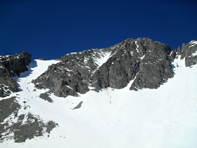
crazy couloir's apron on R, moderate run I ascended on L
nice E-facing run I ascended above hidden lake
SE ridge.  all the rocky walking/scrambling today did some damage to my DyNA EVO race boots.
nothing major but also not sustainable for future use on rocky terrain.  
Despite not yet being 9am, the temps were already soaring so I skied slush down to hidden lake for a water refill.  I then skinned the prominent E-facing run looker’s L of the couloir to gain the SE ridge before scrambling a few hundred feet to the higher S summit.  I took an extended break on top to eat, relax and dry my socks and liners in the sun.  Next up was the S bowl, which held good corn up top followed by slushy skiing for over 2000ft til I ran out of snow, slightly above the unnamed lake downstream from crazy lake. 
a group of skier's on the lower N summit, directly above the snowy chimney you down climb to access the saddle 
S bowl down to unnamed lake.  a portion of crazy lake is visible on far right

such a sad sight...
The skin back up the S bowl was a real scorcher and a slow grind but I persevered.  From the summit, I was little worried about figuring out how to scramble down the broken, rocky terrain to the saddle between the summits but fortunately I found some old mountain goat tracks in the occasional snow patches which helped show me the way.  Once in the saddle, I could see the W couloir became more rock than snow after a mere few hundred feet so I was denied my goal of a 4x4 tour (ski 4 runs on the 4 aspects).  Instead I scrambled up to the N summit where I again took an extended break to dry out my socks and liners before dropping in to the N face. 
W couloir.  note all the rocks 
higher S summit from the north.  note the bootprints to traverse around the rocky tower
dropping in to the N face 
Relying on my memory from the morning’s climb, I was able to forge a route down the rocky upper portion of the face before skiing 2000+ ft. of slush down to my shoes.  A ribbon of snow in the runout zone of the N face provided a nice ski egress before a short jaunt through the woods (mostly skiing) brought me to the trail.  Given it was early June, I was pretty stoked to able to ski to within a 1000 vert of the trailhead.
rocky upper portion of the N face
a lean N face of crazy peak
Less snow coverage in the range than I had hoped for and the super warm temps. prompted me to bail on more skiing the following day and instead head back to bozeman to spend the remainder of the weekend relaxing and running.

Stats:  just shy of 9k in 10.5 hours car-car

Rose: despite the heat, an all-around great day exploring the high point of a new range on skis
Thorn: with non-ski plans in place for the next 2 weekends, my ski season is most likely over…always a tough pill to shallow
Bud: running and climbing adventures in the high country for the next few months!

Thoughts: the scrambling between the 2 summits is slow and non-trivial, there appears to be an abundance of great looking ski terrain in the Crazies, a return trip is certainly warranted ideally in early spring once you could drive within a mile or 2 of the trailhead  

Saturday, May 7, 2016

Holland Peak to Holland Lake Ski Traverse

After a solid few hours of sleep at the trailhead, the usual trio of Brian, Jeffrey and I set out from the cooney lookout/holland peak TH at 5am, excited for a day of skiing adventure along the swan crest.  Our destination was holland lake, where we had dropped a vehicle the previous evening. 
jeffrey on the swan crest, holland peak in the distance
The climbers trail up to rumble lakes is steep and direct and we soon found ourselves at the lower lake, admiring the pink alpenglow on the missions across the valley.  We opted to forgo the buried summer trail to the upper lake and instead boot up the L of two N facing couloirs from the lake to the ridge.  
picture doesn't do it justice.  alpenglow on the missions

lower rumble lake - we gained the ridge via looker's L couloir 
A remaining short climb put us in the sun on the crest of the range where we transitioned and skied a short run E to the bottom of holland’s SE face, so as to avoid the nasty glide cracks that form along the summer S ridge route.  A straightforward boot up the SE face put us on top, which I was excited to visit with skis for my first time. 
brian on the ridge

nasty glide cracks/debris just off holland's S ridge, easily bypassed to the E
skiing holland's SE face (photo: brian)
We were a little early for corn but the face skied well and from the bottom, we made a long sidehill traverse to the S to gain a small but obvious break in the lower E ridge of Buck Mt.  I slapped on skins for the first time of the day and Brian lead the way wrapping around onto the SE face of Buck and up to the summit.  We skied the SE face in good corn conditions down to upper terrace lake and discussed our next move.  We opted to bypass the next highpoint of the crest on the E side and re-gained the crest slightly N of pt. 8450 before trending S to the summit.
a nice depiction of how small and insignificant we are in the mountains.
brian and jeffrey below the N face of buck mt.  
brian leading the charge down buck's SE face
NE face of pt. 8450 - we skied the open portion on looker's R
jeffrey dropping in and headed to woodward lake
With adequate time for another long run, we decided to ski the aesthetic NE face of pt. 8450 to woodward lake.  The upper half skied well however the latter thousand feet to the lake was heavy mush and a real workout on my skinny skis.  After an exciting but successful water refill (another great use for the whippet), we climbed W to the obvious break in the cliffs before making a long traverse to the S above necklace lakes and ultimately back onto the ridgecrest to the holland lookout.   
closing in on the holland lookout (photo: brian)
We skied down the W ridge before nosing our way into the SW bowl and continuing down til we ran out of snow, luckily a mere 10ft from the summer trail.  We transitioned to shoes and embarked on a surprisingly fun 3ish mile run down the trail.  Despite having to drive N back to cooney lookout to get my truck, our early start and strong pace throughout the day put us back in town in time for dinner. 
view from the highway - holland is 2nd from L and holland lookout is far R 
rough breakdown of our route
Thoughts: I seem to easily forget how great the skiing is in the swan.  although the drive and access is a little more than many bitterroot/rattlesnake/mission options, it’s certainly worth skiing in the swan once or twice per season.  there is a lot of good ski terrain around lower and upper rumble lakes with easy access via the bushwhack-free climbers trail 

Stats: approx. 17mi/11k vert in 11:20 point-point
Splits: 4:15 holland, 5:45 buck, 7:30 pt. 8450, 9:45 lookout, 11:20 holland lake TH

Rose: the remoteness and beauty of skiing in the bob marshall wilderness  
Thorn: knowing this is likely one of my last ski outings of the season
Bud: I’ve done holland peak and a holland lake to sunday mt. traverse in the summer but am excited to return this summer for the full smith creek pass to sunday mt. outing (30+mi/14k vert)